


Mont Mezenc

FLORENSAC
User

Length
14.1 km

Max alt
1740 m

Uphill gradient
456 m
Km-Effort
20 km

Min alt
1317 m

Downhill gradient
472 m
Boucle
Yes
Creation date :
2023-07-08 08:34:00.492
Updated on :
2023-07-29 14:05:01.378
6h11
Difficulty : Difficult

FREE GPS app for hiking
 SityTrail
IGN / Geographical institutes
SityTrail Plus
The world is yours!
About
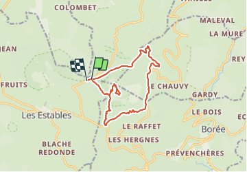
Trail Walking of 14.1 km to be discovered at Auvergne-Rhône-Alpes, Haute-Loire, Les Estables. This trail is proposed by FLORENSAC.
Description
une belle rando
un brin de route bcp de sous bois
Positioning
Country:
France
Region :
Auvergne-Rhône-Alpes
Department/Province :
Haute-Loire
Municipality :
Les Estables
Location:
Unknown
Start:(Dec)
Start:(UTM)
593022 ; 4974284 (31T) N.
Comments